SAN BERNARDINO PASS, SWITZERLAND – ALPINE SHORTCUT
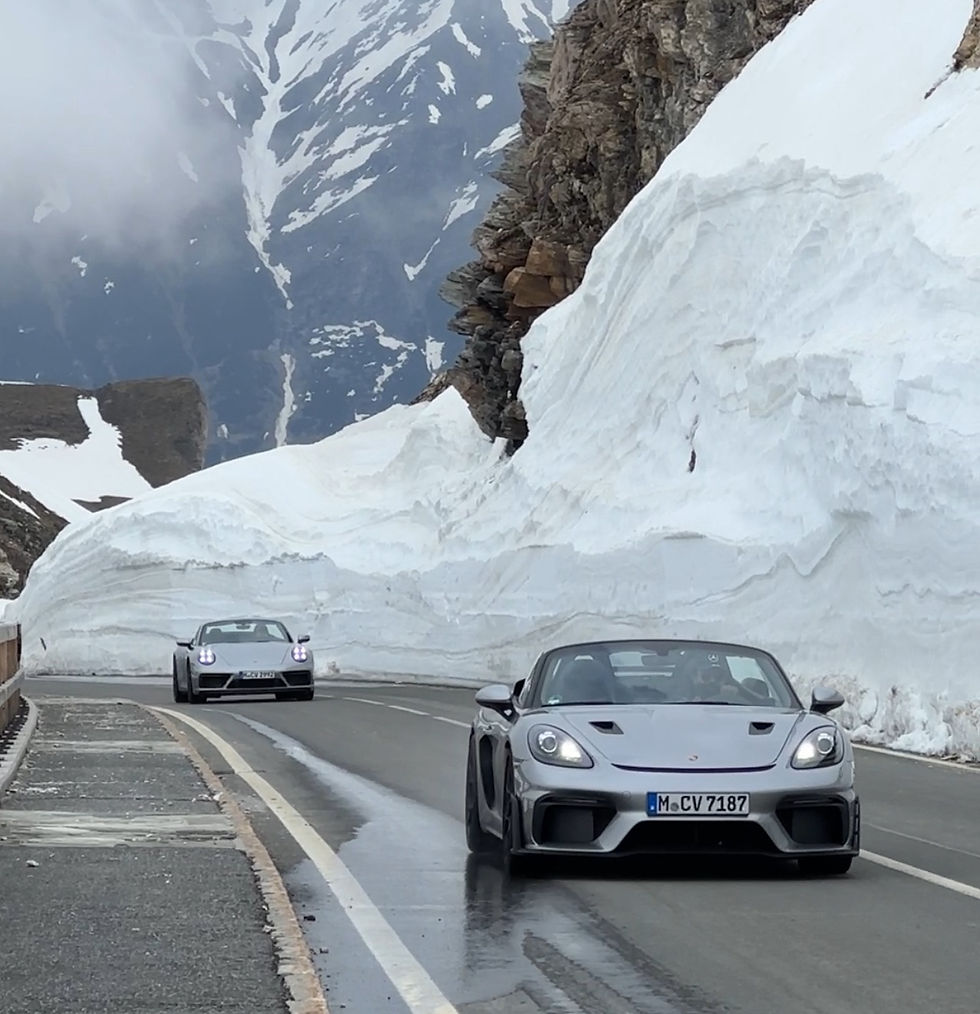
The San Bernardino Pass is one of Switzerland’s most understated Alpine crossings — a historic north–south route linking the German-speaking heart of the country with the Italian-speaking canton of Ticino. Climbing to 2,066 meters (6,778 ft), the pass delivers flowing curves, rugged high-Alpine scenery, and a rare sense of calm. Less dramatic than Stelvio, less busy than Gotthard, San Bernardino rewards drivers who value rhythm, scenery, and space over spectacle.

Scenic: ★★★★☆
Thrilling: ★★★☆☆
WHY DRIVE THE SAN BERNARDINO PASS
San Bernardino feels different from Switzerland’s more famous Alpine passes — and that’s exactly the appeal. Instead of relentless hairpins and crowds, you’ll find:
Smooth, sweeping road geometry
Wide open landscapes and moorland scenery
Minimal traffic even in peak season
A relaxed, almost meditative driving rhythm
It’s an ideal shortcut across the Alps — and a perfect connector within a larger Swiss or Italian itinerary.
DRIVING THE SAN BERNARDINO PASS IN THE SWISS ALPS
The San Bernardino Pass 🇨🇭 runs almost parallel to the Gotthard axis, linking Chur and the Grisons (Graubünden) region with Ticino in southern Switzerland. Instead of diving into the 6.6-km San Bernardino road tunnel, drivers can choose the historic mountain route — a far more scenic and engaging alternative when conditions allow.
The South-to-North Experience (Recommended)
For the best driving flow, we recommend tackling the pass from the south:
Begin in Ticino, Switzerland’s Italian-speaking canton, known for its milder climate and high number of sunshine hours
The road opens with wide, fast curves through forested sections
As elevation increases, scenery transitions into open Alpine terrain
The southern approach feels smooth and elegant — especially well suited to classic cars, grand tourers, and relaxed supercar driving.
The Summit: Lago Moesola
At the top of the pass, the road crosses a high-Alpine plateau at 2,066 meters, framed by:
Glacial rock formations
Alpine bogs and pine trees
Lago Moesola, a serene mountain lake
This area is worth a stop:
Coffee break with views
Short walks across the moorland
The famous stone cairns stacked by visitors over decades
The ecosystem here is particularly rich, hosting one of the highest concentrations of Alpine species in the southern Alps.
The Northern Descent
Descending toward Hinterrhein, the character changes:
Tighter sections with roughly 40 hairpins, mostly on the northern side
Still manageable for inexperienced drivers
Excellent visibility and good road surface throughout
After passing through the village of San Bernardino — which gives the pass its name — the road briefly opens up again before becoming more technical near the final descent.
Overall, the northern side feels more dynamic, while the southern side flows effortlessly.
WHEN TO DRIVE THE SAN BERNARDINO PASS
Best season: June to September
Closed: Typically November to late May (weather dependent)
Tunnel access: Available year-round
The scenic pass itself closes during winter due to snow and avalanche risk, but real-time opening status is published online and should always be checked before planning. Thanks to Ticino’s milder climate, dry conditions on the southern side are common even when weather elsewhere in Switzerland is less stable.
WHY IT WORKS SO WELL IN A LONGER ITINERARY

HISTORY OF THE SAN BERNARDINO PASS
The importance of the San Bernardino corridor long predates modern Switzerland.
Archaeological evidence suggests the route was used in prehistoric times
During the Middle Ages, castles along the valley controlled trade between northern and southern Europe
The route was originally associated with the Via Mala (“bad path”), reflecting the difficulty of early crossings
The pass took its current name in the 15th century, after the village of San Bernardino, and became an important mule track and trading route. Key milestones:
1770 – Road opened to wheeled traffic
1821–1832 – Major improvements for trade
1967 – Opening of the San Bernardino road tunnel, dramatically reducing traffic on the pass
Today, the pass is primarily used for tourism and leisure driving, while remaining a vital alternative route when the tunnel is closed.